

The most popular route to Eryri’s iconic summit
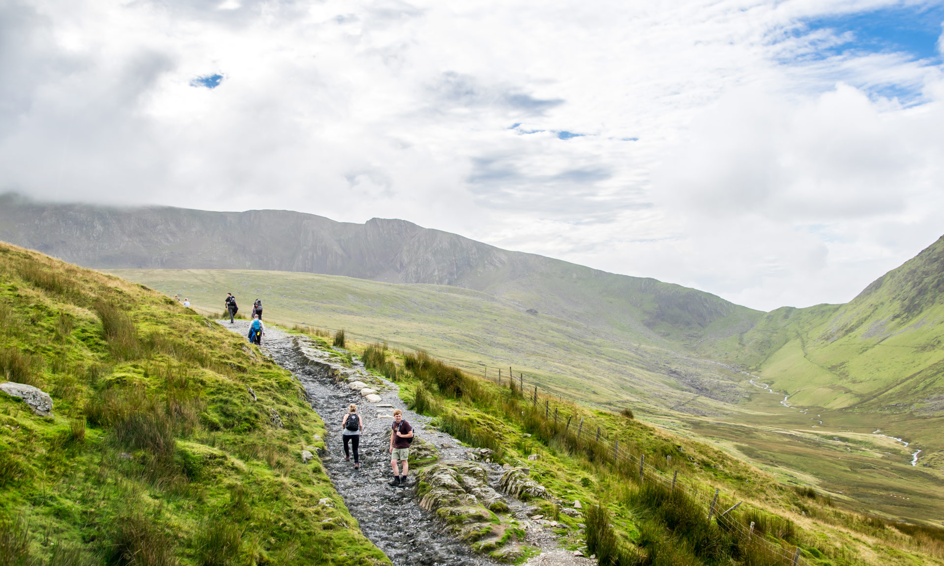
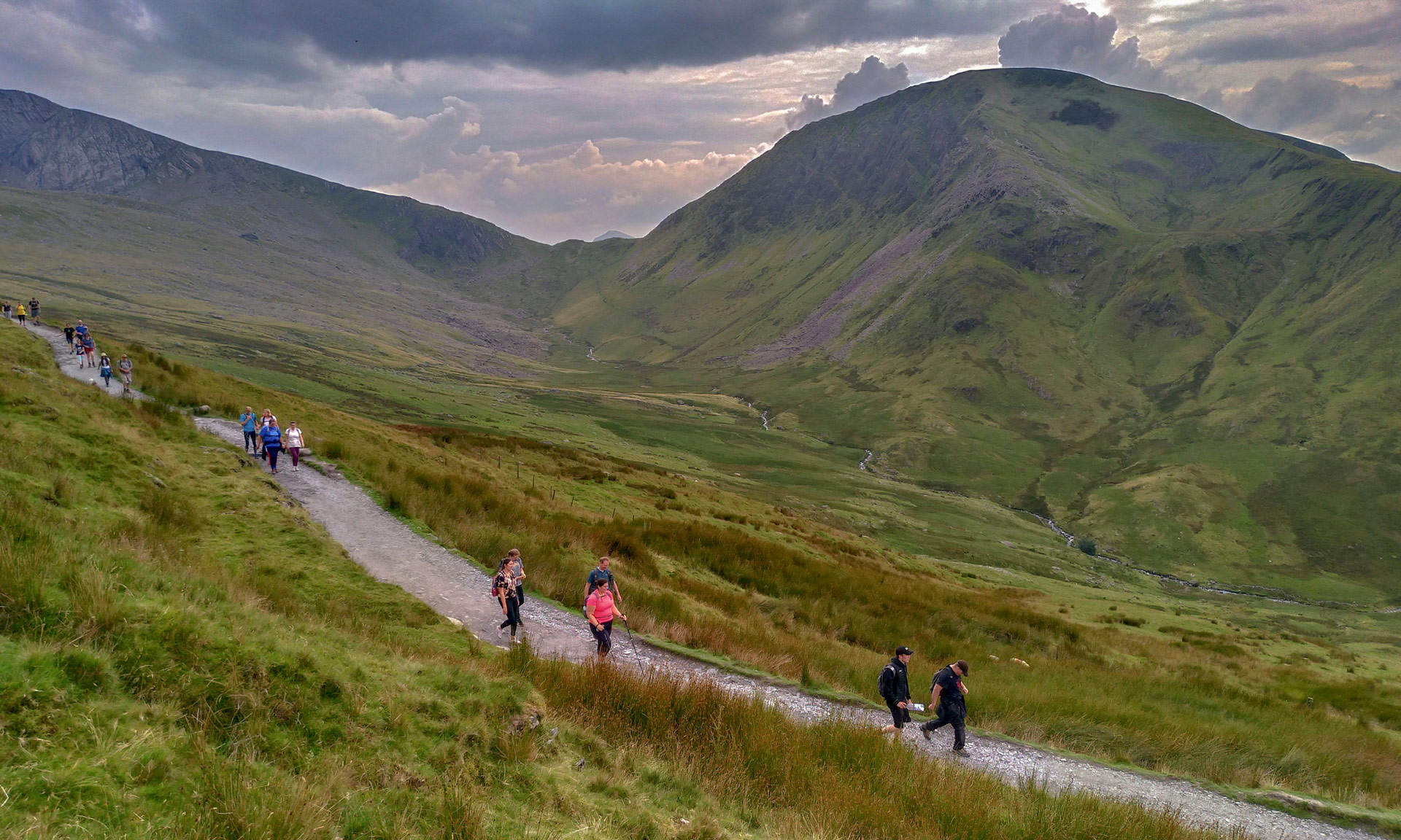
The Llanberis Path is undoubtedly the most popular in the National Park. Over 600,000 people reach the summit of Yr Wyddfa each year, and most walkers take the Llanberis Path to the peak.
As one of the six main routes to the summit of Yr Wyddfa, the Llanberis path is a popular choice for those who are climbing Yr Wyddfa for the first time. While it’s the longest route, it does offer the most gradual climb to the peak.
Why this path?
While the Llanberis Path is often described as the ‘easiest route to the summit’, you should never underestimate any of the routes to the peak of Yr Wyddfa. Reaching the summit of Yr Wyddfa is a challenging undertaking. The National Park Authority classifies Llanberis Path as a hard and strenuous route. A good level of fitness is required and navigation skills are essential.
Yr Wyddfa Ground Conditions Reports
Yr Wyddfa Ground Conditions Reports are now available on the Yr Wyddfa Live website.


© Crown copyright and database rights OS AC0000825604. Use of this data is subject to terms and conditions.
The National Park Authority has categorises this route as Hard/Strenuous. It is only suitable for experienced country walkers with a good level of fitness. Navigation skills are essential. The terrain will include steep hills and rough country and may include some sections of scrambling. Full hill walking gear is essential, and specialist equipment might be required under winter conditions.
Start / Finish
Far end of Victoria Terrace, Llanberis
Relevant OS Map
OS Explorer OL17 (Yr Wyddfa and the Conwy Valley)
Sherpa’r Wyddfa
The Sherpa’r Wyddfa bus service is a convenient service that stops at the trailhead of all six routes to the summit of Yr Wyddfa.
For the Llanberis Path, the best connections are from Betws y Coed, Bangor or Caernarfon.
Llanberis Path Bus Stop
Llanberis Interchange
For more information about getting to Yr Wyddfa, read the National Park Authority’s comprehensive ‘Getting to Yr Wyddfa’ guide or visit the Sherpa’r Wyddfa website.
Parking
There are car parks in the village of Llanberis suitable for the Llanberis Path. Always park in designated parking areas and do not park on side streets or in residential areas.
Yr Wyddfa Ground Conditions Reports are now available on the Yr Wyddfa Live website.
Yr Wyddfa is a challenging mountain to hike. Venturing to the summit should not be taken lightly. Factors such as the seasons, your fitness level, your mountaineering skills, your preparations beforehand, and the mountain’s popularity can all affect your experience of Yr Wyddfa.
Charitable walks and events on Yr Wyddfa are a popular way to raise funds for various charities and organisations. However, you should always take care when taking part in such events. Climbing Yr Wyddfa isn’t an easy undertaking.
A patchwork of upland farms
The rugged landscape of Yr Wyddfa is home to a patchwork of upland farms. Farming has taken place on Yr Wyddfa for many years and is an inherent part of the mountain as well as the National Park as a whole. Remember that you should always keep your dog on a lead when you are crossing agricultural land.
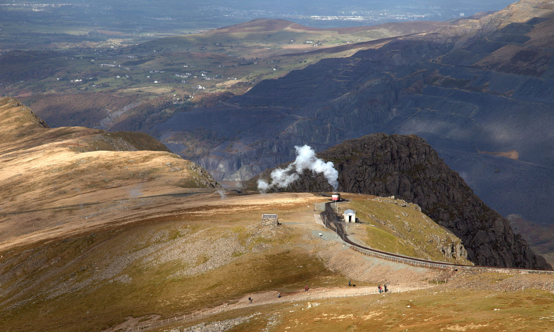
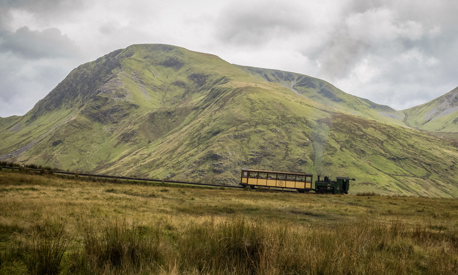
Snowdon Mountain Railway
The mountain railway is by now synonymous with the rugged slopes of Yr Wyddfa. The Llanberis Path is the only path that follows the railway to the summit. During the summer months, you are sure to see a carriage or two along the tracks. A rack and pinion system enables the engines to navigate the ascent to the summit, pushing the carriage in front of it. Some steam engines are over a hundred years old and have climbed the mountain since the railway first opened in 1896.
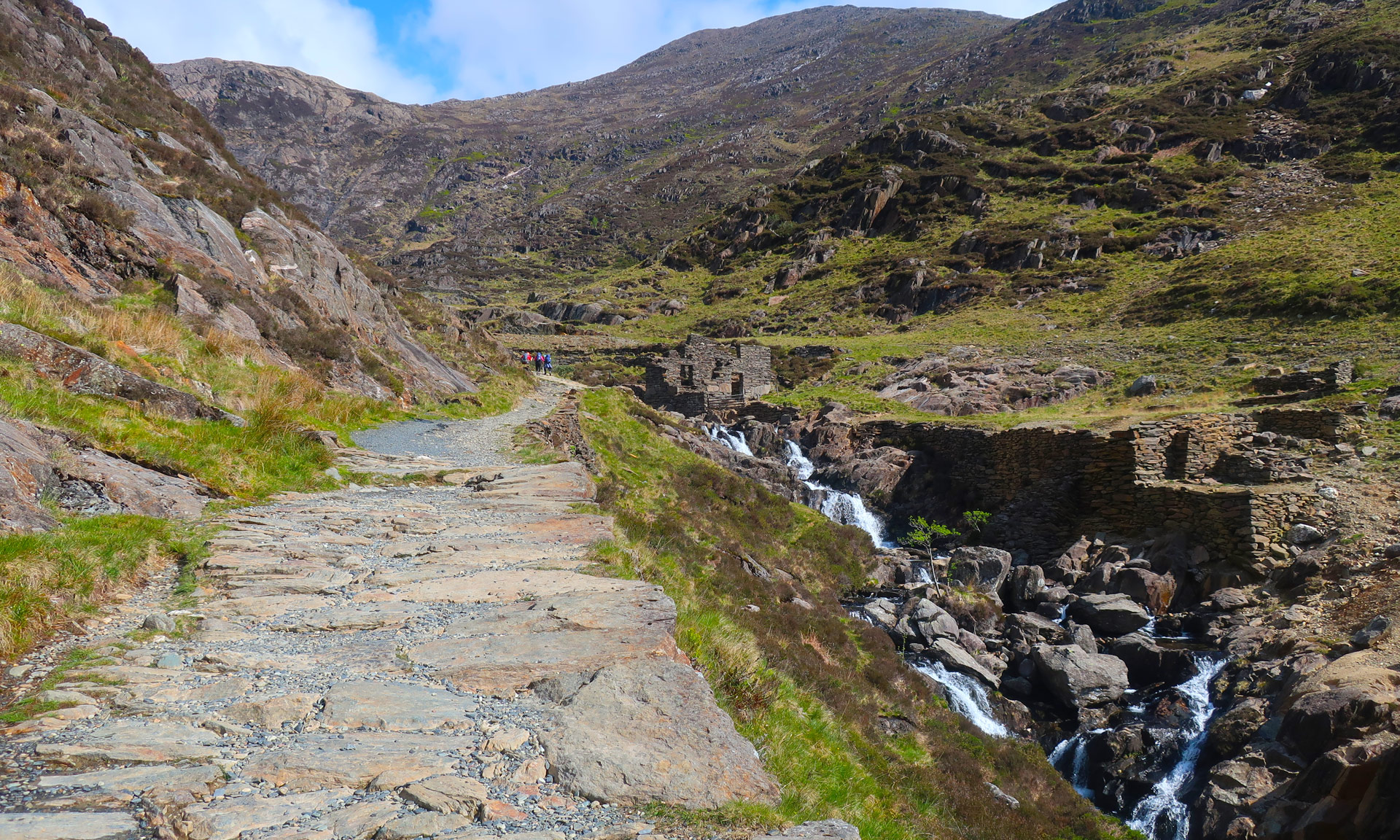
Cwm Brwynog (Brwynog Valley)
Below is Cwm Brwynog valley, where you can see the ruins of once an old close-knit community. The families of Gwaun Cwm Brwynog were tenants to the Faenol Estate, Y Felinheli. The Faenol was the estate of the Assheton Smiths, who owned the Dinorwig slate quarry. Many men from Cwm Brwynog worked the quarry during the week and tended their smallholdings in their spare time.
There were twenty-five dwellings in Gwaun Cwm Brwynog, but no school, shop, pub, electricity or telephone. There was, however, a chapel. The remains of Capel Hebron (Hebron Chapel) can still be seen. Chapels were often the heart and soul of small communities like Gwaun Cwm Brwynog.
By the mid-twentieth century, the community of Gwaun Cwm Brwynog had scattered, and the buildings left for the elements to decide their fate.
Cwm Hetiau (Valley of the Hats)
As you reach Clogwyn, one of three stations along the mountain railway track, you will have arrived at a peculiarly-named spot. This area is known locally as Cwm Hetiau (translated ‘Valley of the Hats’). When Victorian visitors travelled in the train’s open-top carriages, the wind would take hold of their hats and down they went to the bottom of the Llanberis Pass. Local children would collect the hats at the bottom of the pass and sell them to visitors in Llanberis.
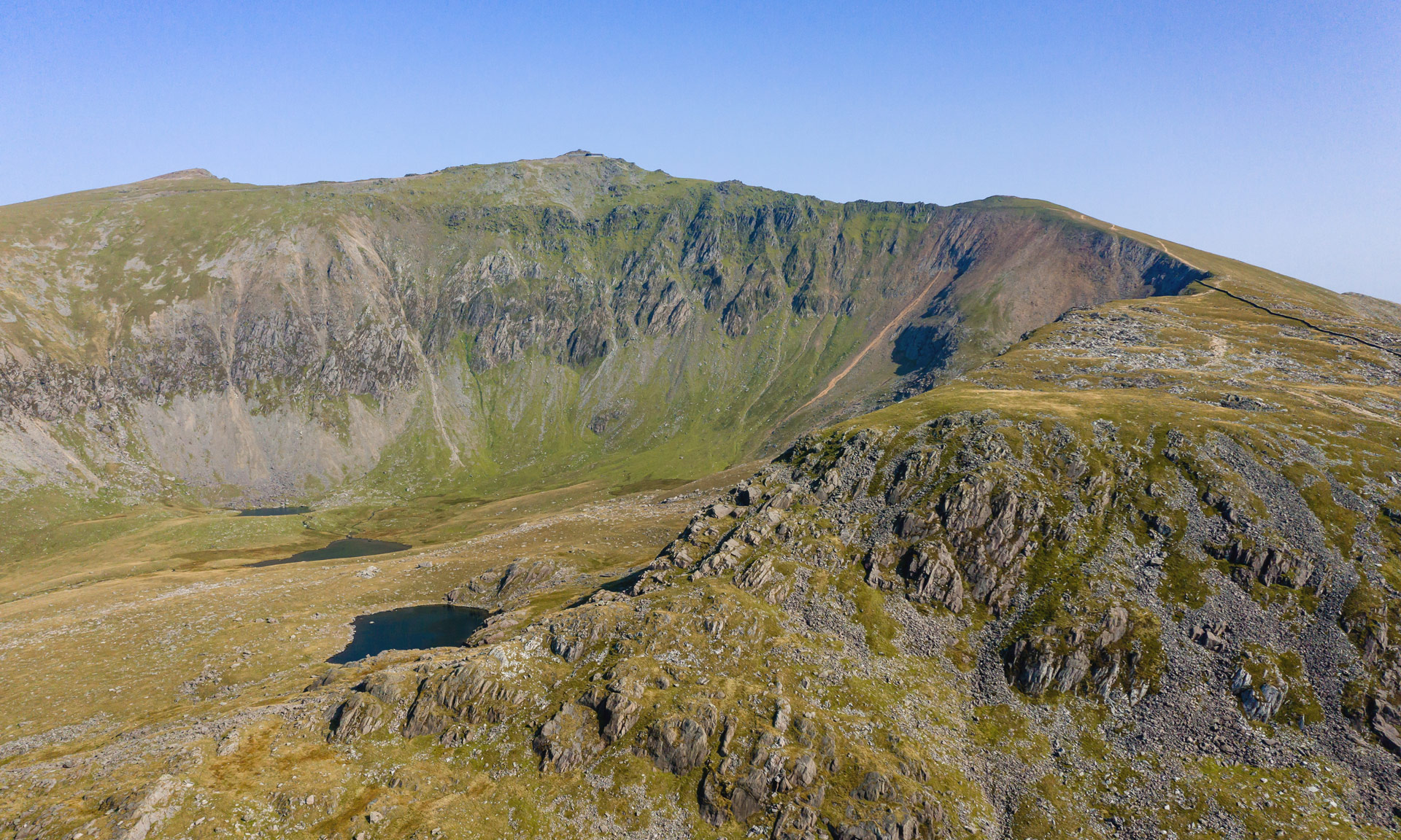
Clogwyn Du’r Arddu
As you ascend the path, you might notice Clogwyn Du’r Arddu—a sheer cliff face facing a northeasterly direction with a small lake at its foot. Clogwyn Du’r Arddu is most famed amongst climbers for its fantastic climbing routes. But it is also a remarkable geological feature—the cliff results from phenomenal geological activity formed over thousands of years. The signs of horizontal deposits transformed into vertical rock layers can be seen clearly on the cliff face.