

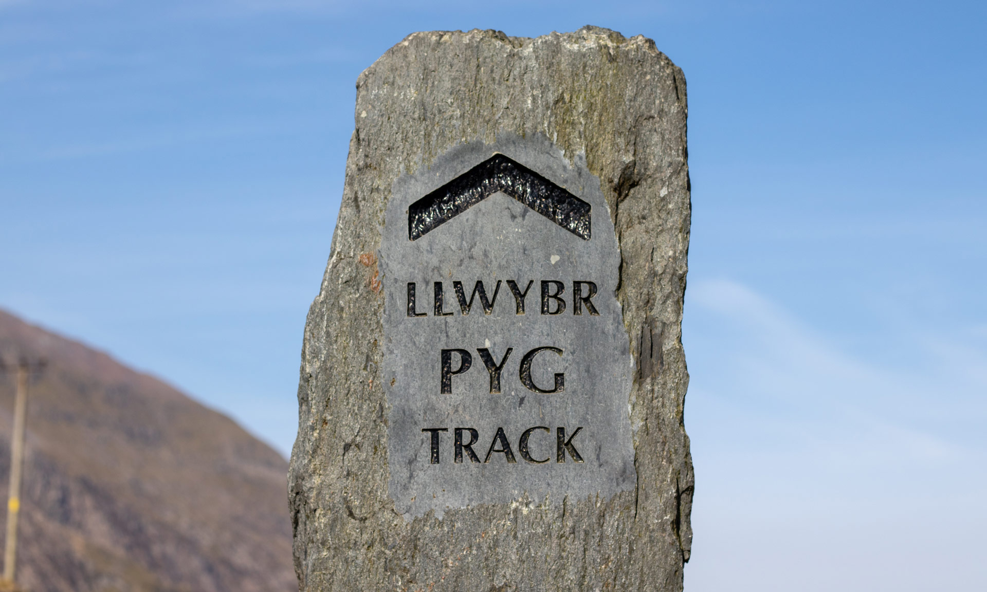
One of two routes starting from Pen y Pass, the Pyg Track is a rocky and difficult path with several steep climbs.
While the Pyg track is one of the shortest routes up Yr Wyddfa, it is the most rugged and challenging route to the summit.
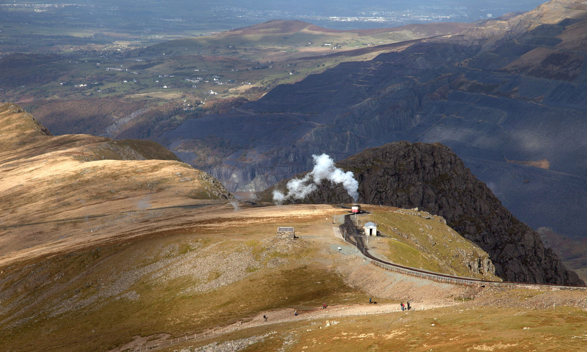
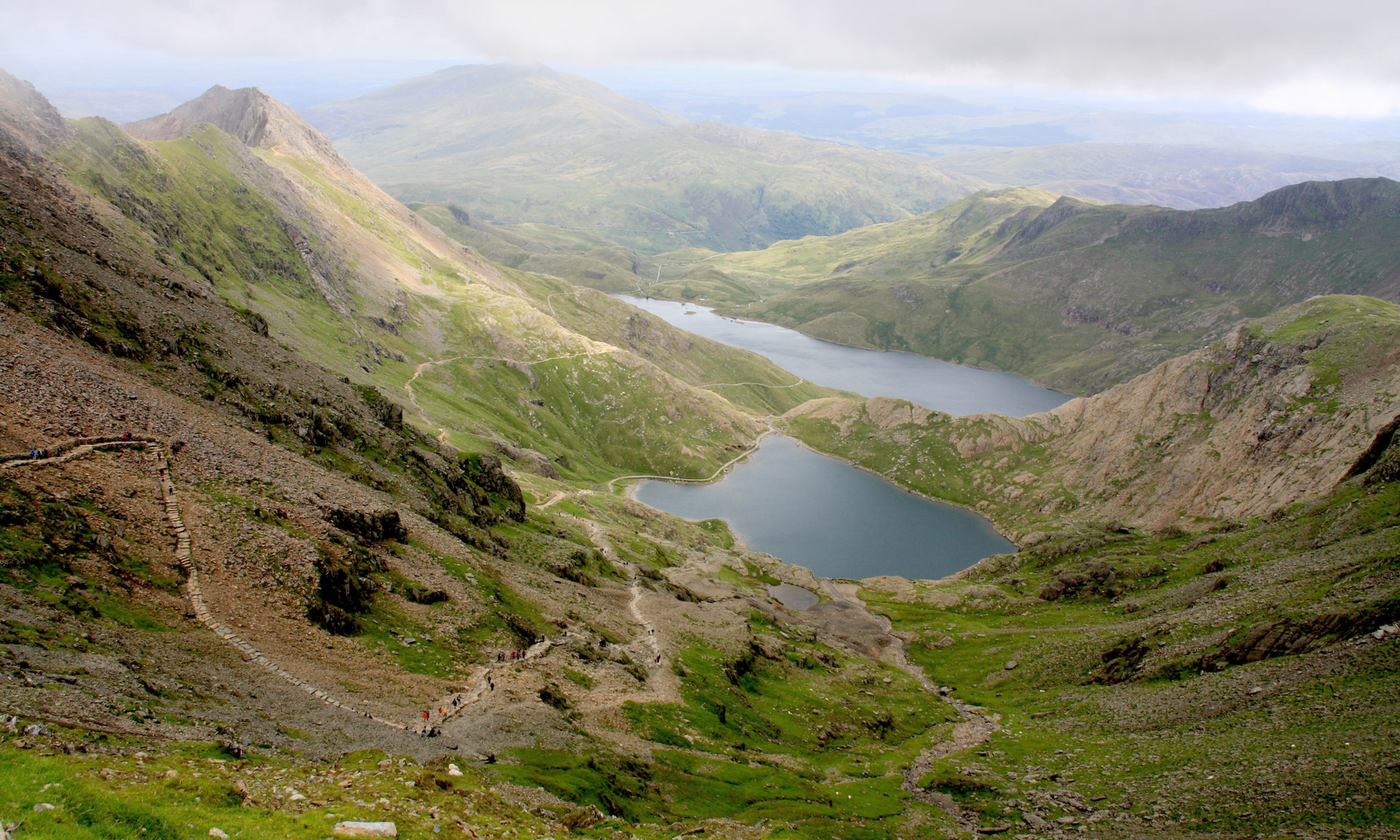
Beginning at Pen y Pass, the Pyg winds its way up to Bwlch y Moch, where you will catch your first glimpse of Llyn Llydaw and its iconic causeway. The Pyg continues until it eventually meets the Miners’ Track up towards Llanberis Path and onwards to the summit.
Important
The Pyg track leads along the foothills of Crib Goch. The route up Crib Goch and along the ridge is extremely dangerous and should only be attempted by experienced mountain walkers.
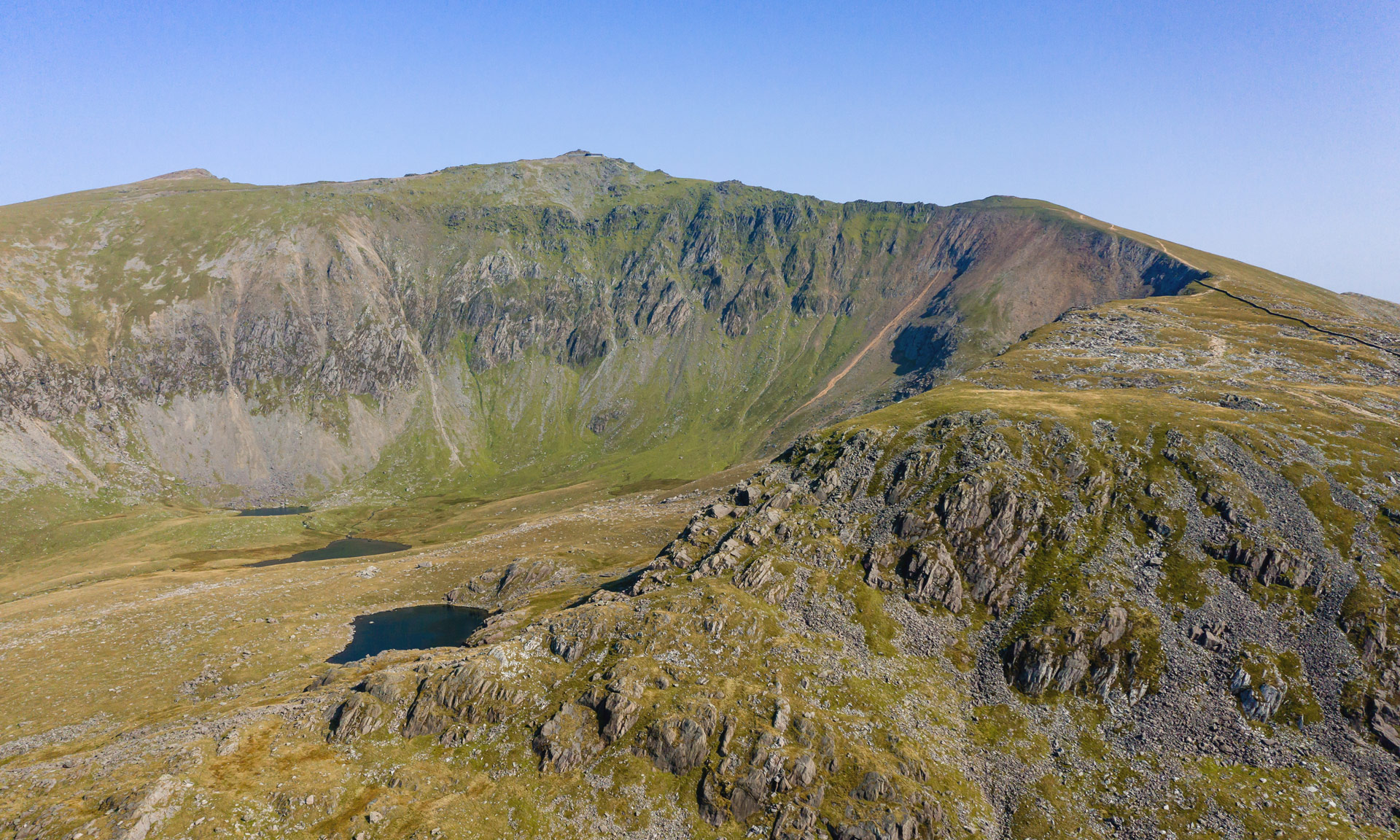
Crib Goch is a 500-metre knife-edge ridge with no escape route. Even in ideal weather conditions, Crib Goch is a difficult undertaking. Crib Goch is a serious mountaineering undertaking in wet weather, wind, snow, mist or ice.
Yr Wyddfa Ground Conditions Reports
Yr Wyddfa Ground Conditions Reports are now available on the Yr Wyddfa Live website.

© Crown copyright and database rights OS AC0000825604. Use of this data is subject to terms and conditions.
The National Park Authority has categorises this route as Hard/Strenuous. It is only suitable for experienced country walkers with a good level of fitness. Navigation skills are essential. The terrain will include steep hills and rough country and may include some sections of scrambling. Full hill walking gear is essential, and specialist equipment might be required under winter conditions.
Start / Finish
Pen-y-Pass Car Park (SH 647 557)
Relevant OS Map
OS Explorer OL17 (Yr Wyddfa and the Conwy Valley)
Sherpa’r Wyddfa
The Sherpa’r Wyddfa bus service is a convenient service that stops at the trailhead of all six routes to the summit of Yr Wyddfa.
For the Pyg Track, the best connections are from Nant Peris or Llanberis. There are also great connections from Betws y Coed, Caernarfon or Bangor.
Pyg Track Bus Stop
Pen y Pass
For more information about getting to Yr Wyddfa, read the National Park Authority’s comprehensive ‘Getting to Yr Wyddfa’ guide or visit the Sherpa’r Wyddfa website.
Parking
Pen y Pass Car Park
Information on Pen y Pass Car Park
If you’re using the Sherpa’r Wyddfa bus service:
Nant Peris Car Park on Google Maps
Llanberis Car Park on Google Maps
Betws y Coed Car Park on Google Maps
Caernarfon Car Park on Google Maps
If you’re parking at Bangor, there are numerous car parks to choose from.
Yr Wyddfa Ground Conditions Reports are now available on the Yr Wyddfa Live website.
Yr Wyddfa is a challenging mountain to hike. Venturing to the summit should not be taken lightly. Factors such as the seasons, your fitness level, your mountaineering skills, your preparations beforehand, and the mountain’s popularity can all affect your experience of Yr Wyddfa.
The Pyg track leads along the foothills of Crib Goch. The route up Crib Goch and along the ridge is extremely dangerous and should not be attempted by novice walkers.
Crib Goch is a 500-metre knife-edge ridge with no escape route. Even in ideal weather conditions, Crib Goch is a difficult undertaking. Crib Goch is a serious mountaineering undertaking in wet weather, wind, snow, mist or ice.
Charitable walks and events on Yr Wyddfa are a popular way to raise funds for various charities and organisations. However, you should always take care when taking part in such events. Climbing Snowdon isn’t an easy undertaking and is not suitable to novice walkers.
The name ‘Pyg’
It is unclear why this path is called the Pyg Track, but there are plenty of plausible explanations. One possibility is that it was named after the pass it leads through, Bwlch y Moch (Pigs’ Pass)—Pyg is sometimes spelt as ‘Pig Track’. Another possibility is that its name is derived from the fact that miners used the path to carry ‘pyg’ (black tar) to the copper mines on Yr Wyddfa.
At the southern foot of Snowdon is the Pen y Gwryd Hotel which could also be the inspiration behind this path’s name. The team who conquered Everest in 1953 stayed in this hotel while training on Yr Wyddfa. Upon their return from the Himalayas, they held a reunion at the hotel, accompanied by Edmund Hillary.
Llyn Llydaw causeway
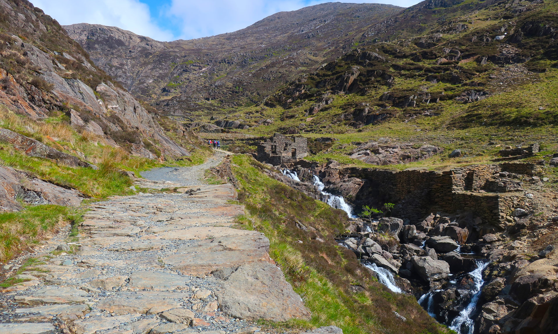
As you ascend the Pyg Track, you will likely see the causeway across Llyn Llydaw. The Miners’ track crosses this causeway. Before being built in 1853, miners of the Britannia Copper Mine used a raft to carry horses and wagons full of copper across the lake. The building work unveiled a prehistoric oak dug-out canoe, measuring 10ft by 2ft providing evidence that man has roamed this mountain for thousands of years.
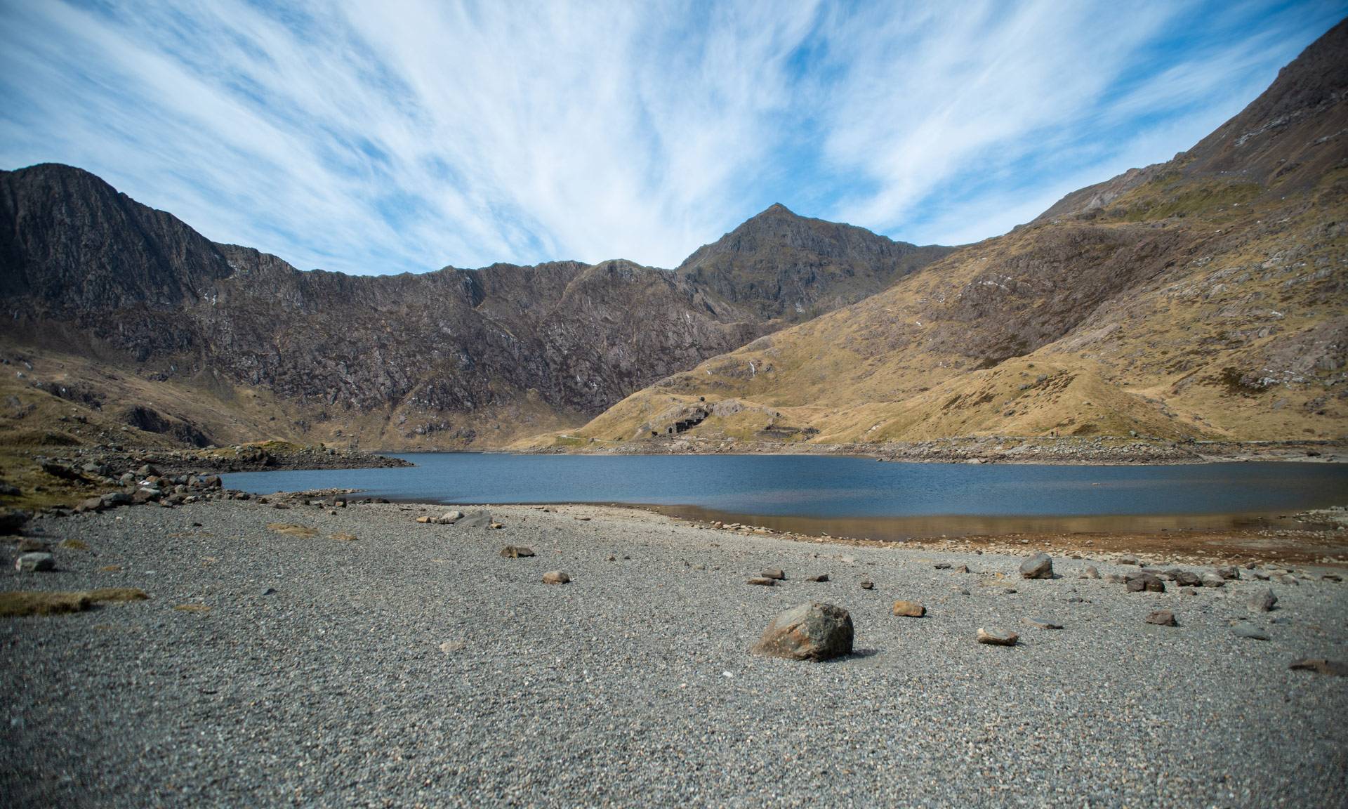
Bwlch y Saethau (Pass of the Arrows)
Looking across Glaslyn, to the left of the summit of yr Wyddfa, you will see Bwlch y Saethau (Pass of the Arrows). Miners from Beddgelert used to climb over this pass with the help of iron chains fixed to the rock.
Legend has it that this is where an arrow struck King Arthur in battle. He was then carried to the shore of Llyn Llydaw, where a boat with three maidens came to take him away through the mist to Afallon (Avalon).